The AI4AGRI newsletter relies on submissions from members of the project, please do not hesitate sharing AI4AGRI related news such as newly published papers, participation to conferences and events as well as information about related events and courses. Please send your submissions at the following address: serge.molina+ai4agri@irit.fr
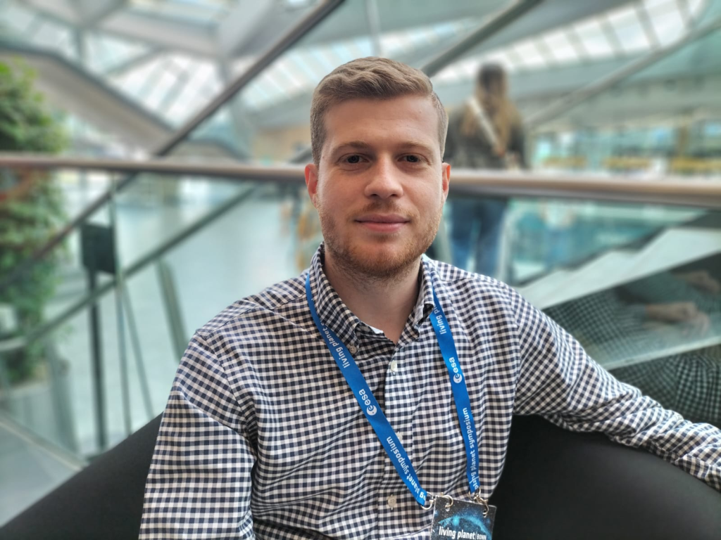
Highlight: Lorenzo Giuliano Papale, University of Rome Tor Vergata
Lorenzo Giuliano Papale began his academic journey with a Bachelor’s degree in Environmental Engineering from Sapienza Università di Roma, where he developed a solid background in addressing environmental challenges. Recognizing the key role of remote sensing in environmental monitoring, he pursued a Master’s degree in Geoinformatics Engineering at Politecnico di Milano. During this time, he gained expertise in processing, storing, and visualizing satellite imagery and geospatial data in general, while developing skills in programming, database management, GIS applications, photogrammetry, and other remote sensing technologies.
As an intern at ESA’s ESRIN center, Lorenzo worked on his Master’s thesis, focusing on the use of Artificial Intelligence (AI) along with Synthetic Aperture Radar (SAR) and optical data for wildfire monitoring. This experience deepened his interest in applying AI to remote sensing technologies.
Now in the third and final year of his PhD in Geoinformation at the University of Rome “Tor Vergata,” his research focuses on developing AI-driven methods combined with physical models to improve the analysis of soil conditions for agriculture. He is particularly focused on using these techniques for soil moisture estimation across various types of crops.
Currently, as a visiting student at NASA’s Jet Propulsion Laboratory (JPL) based in California (US), he is working on soil moisture estimation for agriculture using AI and physical models, applied to SAR data, in preparation for the upcoming NISAR satellite mission. This complements his PhD work by expanding his research into new methods of analyzing soil conditions through AI and satellite data.
Furthermore, Lorenzo collaborates with GEO-K S.r.l., (the first spin-off company of the University of Rome “Tor Vergata”) on research and development projects, focusing on the study of atmospheric instability and convective weather phenomena, using AI and remote sensing technologies to enhance the understanding and prediction of these complex processes.
As part of the AI4AGRI project, Lorenzo is involved in advanced research focused on electromagnetic modeling for synthetic SAR data generating. This work is essential for simulating realistic radar data, which plays a critical role in developing and testing algorithms, particularly in cases where real-world data is scarce or unavailable. Building on this foundation, Lorenzo is also developing AI algorithms aimed at improving soil moisture estimation, ensuring more accurate and reliable predictions across different agricultural areas.
News

Meeting report: AI4AGRI October monthly meeting
📅 Tue. 8 October 2024
October meeting was devoted to the preparation of the MSCA DN proposal.

Visit: Mihai IVANOVICI @ University of Rome Tor Vergata
🧑 Mihai IVANOVICI
📅 Mon. 28 Oct. – Fri. 1st Nov. 2024
📍University of Rome Tor Vergata, Rome (Italy)
Between October 28th and November 1st Mihai IVANOVICI visited Tor Vergata, a report will be published in the next newsletter.
Visit: Rodica Florea and Daniela Voinescu @ University Toulouse Jean Jaures
🧑 Rodica Florea; Daniela Voinescu
📅 Wed. 30 Oct. – Sun. 3rd Nov. 2024
📍UT2J – Toulouse (France)
Between October 30th and November the 3rd Rodica FLOREA and Daniela VOINESCU visited Toulouse’s UT2J university, a report will be published in the next newsletter.
AI4AGRI Events

AI4AGRI Monthly meeting: November
📅 Tue. 12 November – 10:00 (Fr/It time) | 11:00 (Ro time)
Related Events

Défi Clé O3T Young Researchers’ Seminary
📅 Wed. 27 November 2024 – 9:00 a.m. to 5:00 p.m.
📍J. Herbrand Auditaurium, IRIT – Toulouse (France)
The Young Researchers’ Seminar of the Défi Clé O3T will take place on Wednesday, November 27, 2024, at IRIT Auditorium in Toulouse. This day-long event highlights the projects of ten new PhD candidates funded by the first O3T project call, marking the start of their research on territorial transition observation.
Among these, several PhD projects focus on agriculture such as “AgriSoil4Water,” which examines agricultural practices’ impacts on soil and water dynamics, and “GeoTextAI4SAT,” which leverages AI to analyze local food system actors’ trajectories.
The day will run from 9:00 am to 5:00 pm, the program includes project presentations, a poster session and networking opportunities with researchers across related fields. Registration is open, with a detailed program to follow.
Sources
https://o3t.univ-toulouse.fr/seminaire-jeunes-chercheurs-du-defi-cle-o3t/
https://o3t.univ-toulouse.fr/projets-finances/
Latest AI4AGRI Publications
AI4AGRI partners are working on new publications
Related Publications
Bayesian Optimization for Sparse Neural Networks With Trainable Activation Functions
📅 January 2024
🧑 Mohamed Fakhfakh, Lotfi Chaâri
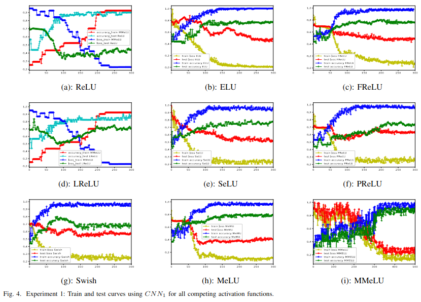
On deep neural networks literature, one important problem is to develop activation functions that can enhance neural network performance. It can be done by training activation functions throughout the learning process. In this paper, the authors develop a trainable activation function which parameters need to be estimated. The idea is to use a fully Bayesian model that automatically estimates from the learning data both the model weights and activation function parameters. The inference is built using an MCMC-based optimization scheme. While the model is tested on medical and general image data sets, the results show the usefulness of the method in improving model accuracy due to the proposed activation function and Bayesian estimation of the parameters. Such a method could also be used on Earth observation data.
Related in AI, Agriculture and Earth Observation
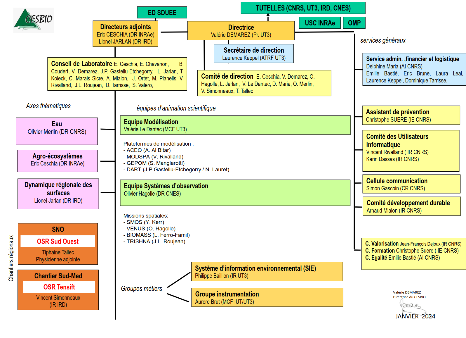
CESBIO: Centre d’Etudes Spatiales de la Biosphère (Center for Biosphere Spatial Studies)
The Center for Biosphere Spatial Studies is a French research institute dedicated to understanding the Earth’s biosphere through satellite data and remote sensing. Based in Toulouse,CESBIO is a Joint Research Unit (UMR 5126) supported by the CNES, CNRS, Université Paul Sabatier, and the institute for research and development. CESBIO’s mission is to develop knowledge about the functioning of the continental biosphere, making extensive use of satellite remote sensing, pushing our understanding on how natural and human-induced changes affect ecosystems on a global scale.
CESBIO’s research spans various fields, from monitoring vegetation and soil moisture to assessing water resources and their availability. The institute uses data from satellites to track changes in vegetation cover, study agricultural landscapes, and investigate hydrological cycles.
As a founding member of the THEIA Land Data Center, CESBIO produces and disseminates quality satellite data to facilitate environmental observation. Through these efforts, CESBIO advances scientific understanding and informs policies to address pressing environmental challenges.
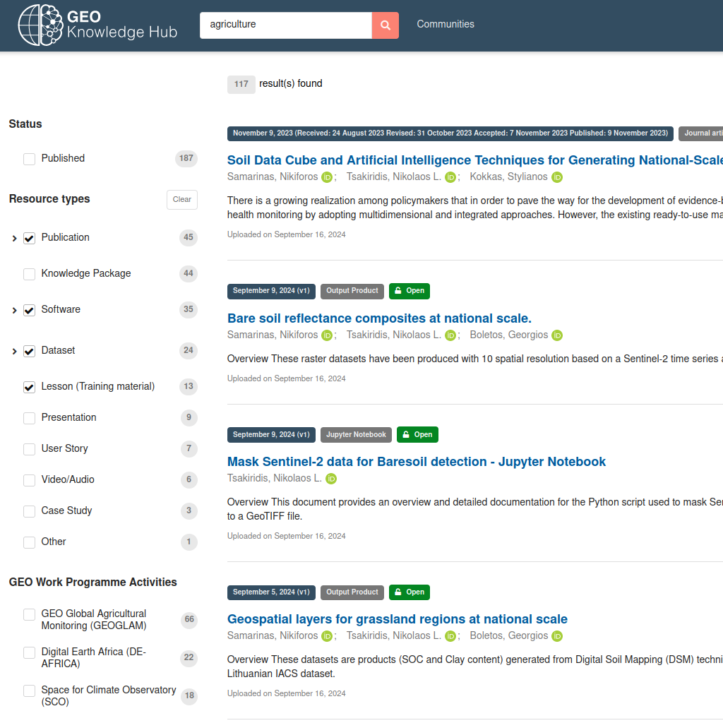
GEO Knowledge Hub: Advancing Global Challenges with Open Earth Observation Data and Collaborative Resources
The GEO Knowledge Hub is an online platform developed by the Group on Earth Observations (GEO) to make Earth observation data and related resources more accessible for researchers, policymakers, and practitioners. This platform facilitates the sharing of open data, tools, and methodologies that help users address a variety of global challenges. By compiling Earth observation resources in one place, the GEO Knowledge Hub supports informed decision-making on critical issues such as climate change, disaster resilience, and sustainable development.
The platform provides “Knowledge Packages” that bundle together datasets, analytical tools, and case studies related to specific thematic areas. These packages showcase successful applications of Earth observation data, offering replicable examples and insights for users interested in tackling similar problems in their own regions or sectors. The platform is built to be interoperable, which means it allows users to integrate data from various sources seamlessly. This functionality enhances the capacity for multi-disciplinary analysis and enables a holistic approach to solving complex issues.
Sources
https://gkhub.earthobservations.org
https://gkhub.earthobservations.org/doc/

AI Doctoral Academy (AIDA): Beginning of the Fall/Winter 2024 semester
For the Fall 2024/Winter 2025 semester, AIDA is offering an exciting lineup of courses on cutting edge topics such as Constraint Programming, Big Data Analytics for Natural Disaster Management and Advanced Computer Vision among others.
Furthermore, the AI Excellence Lecture Series will continue, offering free online lectures accessible to everyone such as:
- Decentralized DNN architectures for big data analysis
- Manifold / geometric deep learning and its application for multimedia
- Text-driven 3D human motion synthesis
- LLMs for More Reliable Small Data Learning
With courses added regularly, this semester provides an ideal opportunity for students and professionals to explore the latest advancements in AI through courses from top universities across Europe.
Sources
https://ci2s-enterprise.com.ar/2024/09/19/call-for-fall-2024-international-ai-doctoral-academy-aida-course-proposals/
https://www.i-aida.org/past-courses/?category=semester
Email exchanges with AIDA members
The AI4AGRI project received funding from the European Union’s Horizon Europe research and innovation programme under the grant agreement no. 101079136.
Publishing managers: J. Mothe & S. Molina, UT3 & UT2, IRIT, France

