

Enhancing Domain-Specific Named Entity Recognition via Segmentation and Pseudo-Labeled Annotation
📅 July 2025
🧑 Corneliu Florea, Laura Florea, Mihai Ivanovici
📅 July 2025
🧑 Corneliu Florea, Laura Florea, Mihai Ivanovici
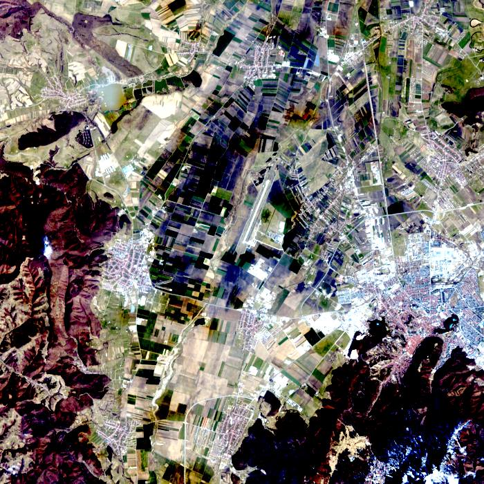
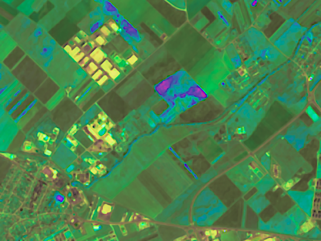
The HyDACI6 dataset was produced within the framework of the AI4AGRI European project GA 101079136. HyDACI stands for Hyperspectral Dataset for Agricultural Crop Identification. The AI4AGRI HyDACIA6 data set contains six hyperspectral images derived from the PRISMA mission data from year 2024 over a specific area to the north of Brașov city, Romania. The original
AI4AGRI HyDACI6 PRISMA-based data over Brasov area for agricultural crop identification Read More »
We are pleased to announce an open data challenge aimed at students and early-career researchers with experience or interest in machine learning, data science, Earth observation, and agricultural applications, focused on the DACIA5 dataset. The dataset is publicly available at Zenodo – https://zenodo.org/records/14283243 and was originally introduced in the publication: “DACIA5: a Sentinel-1 and Sentinel-2
📅 July 2025
🧑 Corneliu Florea, Laura Florea, Mihai Ivanovici
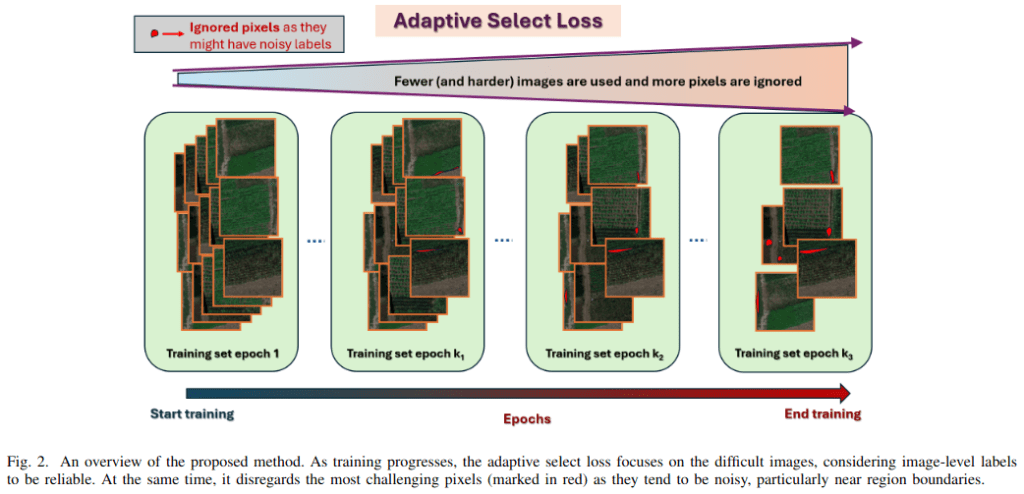
Adaptive Select Loss Strategy for Semantic Segmentation of Agricultural Crop Images Read More »
📅 June 2025
🧑 Cristian George Fieraru, Maria Biserică, Ioana Cristina Plajer, Mihai Ivanovici
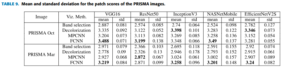
Comparing Blind Image Quality Metrics for Reliable Image Assessment Read More »
📅 June 2025
🧑 Andreea Nițu, Corneliu Florea, Mihai Ivanovici, Andrei Racoviteanu
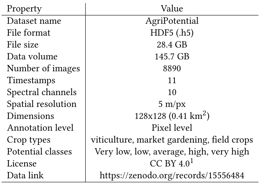
🧑 Mohammad El Sakka, Caroline De Pourtales, Lotfi Chaari, Josiane Mothe Resources Description Published as part of AI4AGRI, the AgriPotential dataset provides an open-access benchmark for modeling and predicting agricultural potentials using remote sensing and machine learning. It integrates multispectral Sentinel-2 satellite imagery across 2019 and expert-labeled ground truth from the BD Sol – GDPA
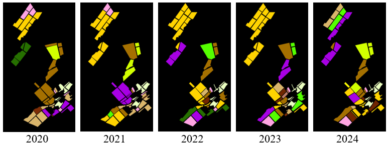
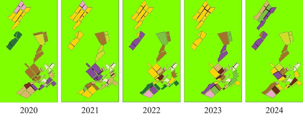
As part of the AI4AGRI project, a new dataset is now available that combines Sentinel-1 SAR and Sentinel-2 multispectral imagery to support research in crop identification using machine learning and remote sensing. Covering the years 2020 to 2024 over an agricultural area north of Brașov, Romania, this dataset is structured to address two key tasks:
As part of the AI4AGRI project, a new dataset is now available for researchers focusing on crop identification using remote sensing and machine learning techniques. The dataset consists of Sentinel-2 MSI images acquired between 2020 and 2024 over an area north of Brașov, Romania. It is designed to support two specific tasks: The dataset includes: