📅 July 2023
🧑 I. Plajer, A. Baicoianu, L. Majercsik
#Visualization #Interpolation #Satellites #Image color analysis #Military computing #Neural networks #Military satellites
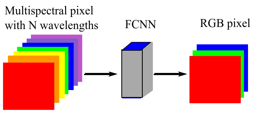
With the increase in multispectral and hyperspectral satellite data availability, the necessity of interpreting and processing such data is also growing. Satellite imagery can be used in a wide range of fields, from military and defence applications to ecology, agriculture and forest management. As multi- and hyperspectral images cannot be directly interpreted either by the human eye or by usual computer displays, a visually-consistent mapping of these images is necessary. In this paper we propose an approach based on an artificial intelligence (AI) model for spectral image visualisation in the RGB color space. The visualization is performed by a fully-connected neural network trained on the popular CAVE dataset which we consider being suitable for visualization, as it has a significant color diversity in the visible domain. The coloring method was applied on a hyperspectral PRISMA image. The study offers a visual interpretation of the results obtained with the proposed architecture. The results are promising and will be further used for the true mapping of agricultural areas.
http://ai4agri.unitbv.ro/wp-content/uploads/2024/04/I_C_Plajer_ISSCS_2023.pdf
Plajer, I.C., Baicoianu, A. and Majercsik, L., 2023, July. AI-based visualization of remotely-sensed spectral images. In 2023 International Symposium on Signals, Circuits and Systems (ISSCS) (pp. 1-4). IEEE.
@inproceedings{plajer2023ai,
  title={AI-based visualization of remotely-sensed spectral images},
  author={Plajer, Ioana Cristina and Baicoianu, Alexandra and Majercsik, Luciana},
  booktitle={2023 International Symposium on Signals, Circuits and Systems (ISSCS)},
  pages={1--4},
  year={2023},
  organization={IEEE}
}
