
The HyDACI6 dataset was produced within the framework of the AI4AGRI European project GA 101079136. HyDACI stands for Hyperspectral Dataset for Agricultural Crop Identification. The AI4AGRI HyDACIA6 data set contains six hyperspectral images derived from the PRISMA mission data from year 2024 over a specific area to the north of Brașov city, Romania. The original PRISMA data was kindly provided by the Italian Space Agency (ASI) and this derived dataset is made publicly available as open data with written permission from ASI. The data set also includes a mask, the crop legend, and the wavelengths of the image spectral bands.
The directory images_2024 contains the 6 Level 2C PRISMA data-derived hyperspectral images over the area of interest. The images are named with the acquisition date and saved in .mat format. The dimensions of the images are 700 x 700 x 187, specifically, each image has a height of 700 pixels, a width of 700 pixels and 187 spectral bands, with a spatial resolution of 30 meters. From the original 239 spectral bands, the water absorption bands were eliminated. The spectral bands (wavelengths) are expressed in nm and provided in .csv and .xls formats.
The directory mask_legend contains the ground truth of agricultural crops as a colour RGB mask in .png format and the labels corresponding to each agricultural crop in both .png and .mat formats. The mask was manually generated on the PRISMA image acquired on 14 May 2024 and may not be perfectly aligned at pixel-level in all the other images. The same directory also contains the legend for the colours of the mask in .pdf format, using the colour codes from the US Department of Agriculture. The ground truth was generated based on the information provided by the National Institute of Research and Development for Potato and Sugar Beet Brașov, Romania.
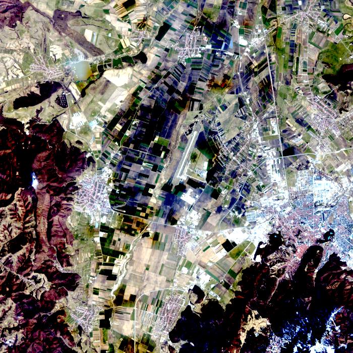
The directory RGB_composites contains the color RGB visualization of the hyperspectral data using the approach presented in I. C. Plajer, A. Băicoianu, L. Majercsik and M. Ivanovici, “Multisource Remote Sensing Data Visualization Using Machine Learning,” in IEEE Transactions on Geoscience and Remote Sensing, vol. 62, pp. 1-12, 2024, Art no. 5510912, DOI: 10.1109/TGRS.2024.3372639.
Funded by the European Union. The AI4AGRI project entitled “Romanian Excellence Center on Artificial Intelligence on Earth Observation Data for Agriculture” received funding from the European Union’s Horizon Europe research and innovation programme under the grant agreement no. 101079136. Views and opinions expressed are however those of the authors only and do not necessarily reflect those of the European Union. Neither the European Union nor the granting authority can be held responsible for them.
PRISMA Product – © Italian Space Agency (ASI) 2024. All rights reserved.