
🧑 Mohammad El Sakka, Caroline De Pourtales, Lotfi Chaari, Josiane Mothe
Resources
- Tutorial & Code
- Dataset
- Paper
Description
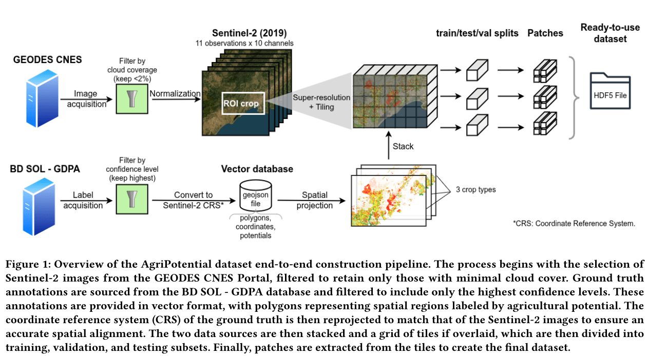
Published as part of AI4AGRI, the AgriPotential dataset provides an open-access benchmark for modeling and predicting agricultural potentials using remote sensing and machine learning.
It integrates multispectral Sentinel-2 satellite imagery across 2019 and expert-labeled ground truth from the BD Sol – GDPA database.
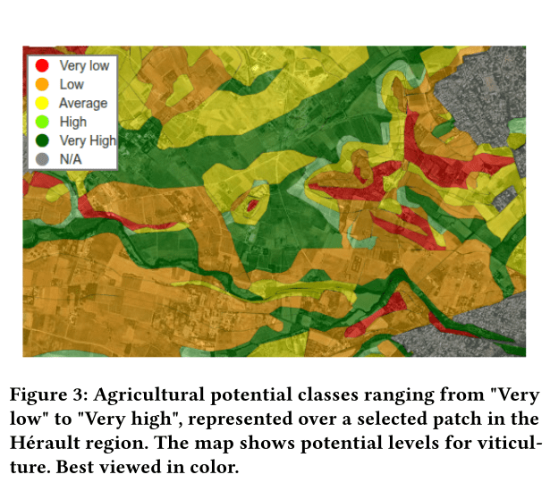
The dataset focuses on assessing suitability for three major crop types, viticulture, market gardening, and field crops, across five levels of potential: Very Low to Very High.
Covering a Mediterranean region in Hérault, Southern France, AgriPotential is designed to support multiple machine learning tasks, including:
- Ordinal classification and regression
- Multi-label classification
- Segmentation and spatio-temporal modeling
Dataset features
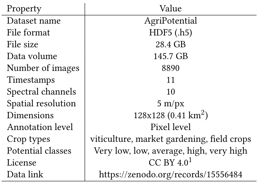
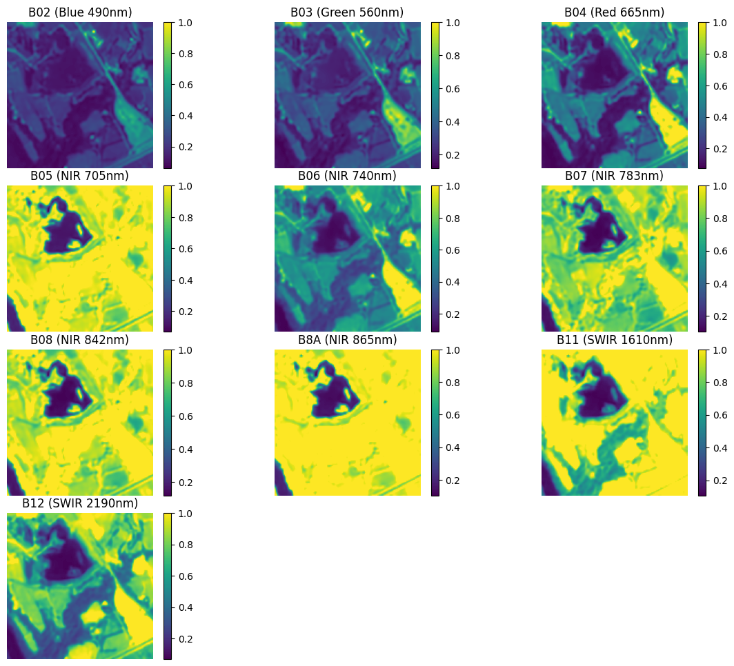
- Sentinel-2 Satellite Images: 11 monthly observations from 2019, selected with <2% cloud cover and super-resolved to 5 m/pixel resolution across 10 spectral bands.
- Pixel-Wise Agricultural Potential Labels: Derived from BD Sol – GDPA, validated by domain experts, and aligned to satellite imagery.
- Three Crop Types: Labels are provided independently for viticulture, market gardening, and field crops.
- 8,890 spatio-temporal patches (128×128 pixels) organized into training, validation, and test sets.
- Multi-Dimensional Support: The data integrates spectral, temporal, and spatial dimensions, making it ideal for deep learning research.
Use cases
- Land suitability analysis and crop recommendation systems
- Remote sensing-based agricultural planning
- Benchmarking spectral-temporal models using high-resolution satellite data