
Member highlight: Davide De Santis – Tor Vergata University, Roma (Italy)
Davide De Santis received the Ph.D. in Computer Science, Control and Geoinformation and the M.Sc. degree in Environmental Engineering (cum laude) from Tor Vergata University of Rome (TVU) in 2022 and 2017, respectively. He is currently a researcher at TVU affiliated to the Civil Engineering and Computer Science Engineering Department.
His research interests mainly include optical remote sensing, machine learning and climate change. His PhD thesis, titled “Application of Machine Learning for Air Quality Monitoring from Space”, presents a novel AI-based approach for estimating various types of atmospheric aerosols using data from satellite and the Copernicus Atmosphere Monitoring Service (CAMS). As part of this work, an automated processing chain was developed to generate satellite simulated spectral radiances using the radiative transfer model “libRadtran”.
His current research activities are focused on air quality monitoring exploiting Earth Observation data, radiative transfer models and artificial intelligence algorithms.
He is a reviewer for several scientific journals, including Remote Sensing of Environment, IEEE Transactions on Geoscience and Remote Sensing and Scientific Reports.
Since 2020, he has been supporting the teaching of the “Remote Sensing and Cartography” course at Tor Vergata University of Rome. He is also a lecturer for the “Earth Observation” course in the Second-Level Master’s Program in “Space Science and Technology” at the same university. He has been involved as a scientific advisor in several research projects funded by the European Space Agency (ESA) and the Italian Space Agency (ASI). He serves as co-leader of the Working Group on Physical Model Informed Machine Learning (PIML) within the IEEE Modeling in Remote Sensing (MIRS) Technical Committee.
He has also organized and participated as a lecturer in several workshops and summer schools within the framework of international projects, such as the InnEO Space PhD Horizon 2020 project, focusing on the estimation of biogeophysical parameters using Earth observation data and artificial intelligence.
News
AI4AGRI Monthly meeting report: January
- AI4AGRI 2025 Summer School planning (2024 summer school)
- Discussion of the new AI4AGRI6.0 proposal potential partners
- Preparation of the AI4AGRI project evaluation
- Organisation questions
New AI4AGRI dataset: Sentinel-2 Imagery for Crop Identification
As part of the AI4AGRI project, a new dataset is now available for researchers focusing on crop identification using remote sensing and machine learning techniques. The dataset consists of Sentinel-2 MSI images acquired between 2020 and 2024 over an area north of Brașov, Romania. It is designed to support two specific tasks:
- Crop Identification with Temporal Generalization: Training models on data from 2020–2023 and testing on data from 2024.
- Early Crop Identification: Identifying crops during the vegetation season, splitting data into training and testing accordingly.
The dataset includes:
- Sentinel-2 GeoTIFF Images: Stored by year, with a resolution of 800 x 450 pixels and 12 spectral bands at 10 m spatial resolution.
- Ground Truth Masks: RGB and labeled masks of agricultural crops, saved in PNG and MAT formats, along with a legend in PDF format.
- 32×32 Pixel Multi-Spectral Patches: Subsets of the imagery for focused analysis, stored in GeoTIFF and MAT formats.
This dataset offers a resource for testing crop identification models under varying temporal and seasonal conditions. It is structured for straightforward integration into machine learning workflows, supporting both generalization and early identification tasks.
AI4AGRI Upcoming Events
Next AI4AGRI Monthly meeting
📅 Tue. 25 February – 14:00 (Fr/It time) | 15:00 (Ro time)
Prof. Fabio Del Frate’s seminar: PRISMA-based applications in agriculture and the AI4AGRI project
📅 Fri. 14 February – 14:00 (Fr/It time) | 15:00 (Ro time)
📍 online
In the context of the Horizon Europe EXPERT project, Prof. Fabio Del Frate from the AI4AGRI project will give a seminar on PRISMA-based applications in agriculture and the AI4AGRI project.
The remote access link has been shared between the AI4AGRI members.
Related Upcoming Events
World FIRA 2025: An event dedicated to autonomous farming solutions
📅 Tue. 4 – Wed. 6 February 2025
📍 Agrobiopole – Toulouse, France
The event will feature over 40 robots performing in-field demonstrations across various agricultural settings, including field crops, vegetables, vineyards, orchards, and livestock. Attendees can engage in expos, conferences, networking opportunities, and entertainment activities. Special highlights include panel discussions with international experts, a scientific workshop showcasing research projects from labs and universities, and an “Invest’ Day” where agricultural robotics startups can connect with investors through pitch sessions and awards.
Financial access to the event can be facilitated under the following criteria:
- Free for farmers
- Special rates for groups over 5 persons
- Free for students
- Free accreditation for journalists
Visit the official website for registration and more info!
Call for Contributions: UNIVERSEH PhD Workshop on AI and Space (online)
📅 Tue. 3 – Wed. 4 June 2025
📍 online
“We are excited to announce the upcoming multidisciplinary PhD Workshop on AI and Space, organized by Heinrich Heine University Düsseldorf and the University of Toulouse Jean Jaurès within the framework of the European University Alliance UNIVERSEH (European Space University for Earth and Humanity). The workshop will take place on June 3-4 2025 (online) and is open to PhD students from all disciplines researching Space-related topics.
Day One will offer a general introduction to AI, followed by an introduction to the intersection of AI and Space, providing a comprehensive foundation for researchers from diverse backgrounds.
Day Two will focus on Earth Observation and its applications across different research disciplines, exploring how AI technologies are advancing our understanding of the planet.
Don’t miss this opportunity to engage with cutting-edge topics at the crossroads of AI and Space!
Further details on the program and registration will follow shortly!”
Source: Call for contribution and preliminary agenda – AI PhD workshop – UNIVERSEH
This workshop will involve members of AI4AGRI:
- Josiane Mothe from University of Toulouse: Introduction to AI & Space
- Fabio Del Frate from University Tor Vergata: Earth Observation applications
Please send your submissions to universeh@univ-tlse2.fr to participate in the PhD Workshop on AI and Space.
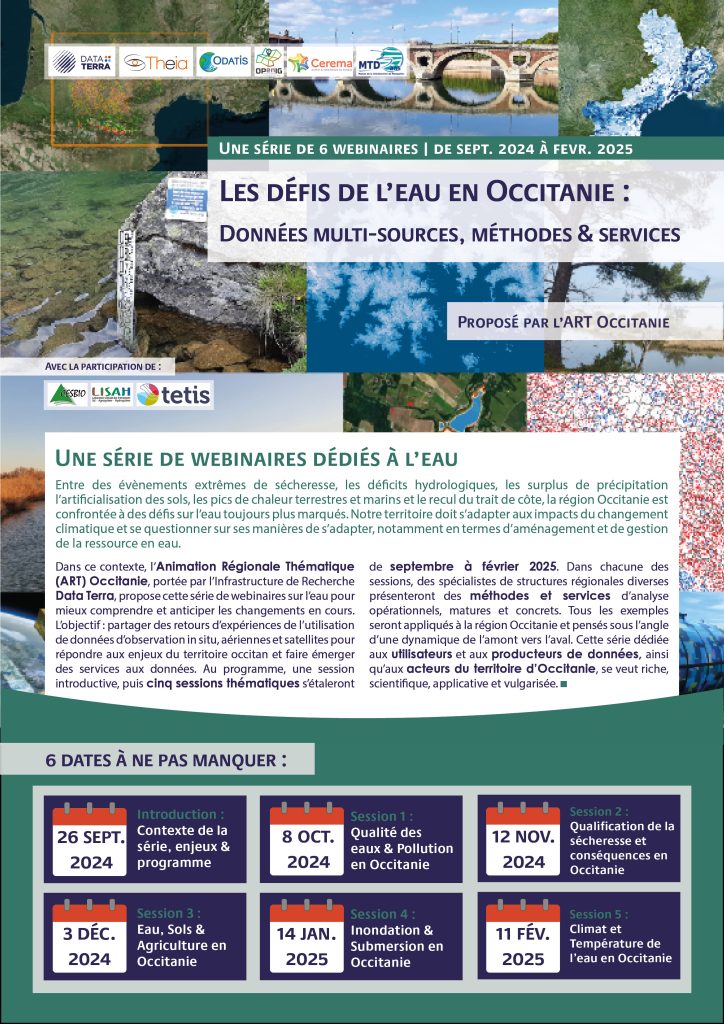
Water Challenges in Occitania – Webinar Series
📅 Tue. 11 February 2025
📍 online
“Between extreme drought events, hydrological deficits, rainfall surpluses, soil artificialisation, heat peaks on land and at sea, and retreating coastlines, the Occitanie region is facing ever-increasing water-related challenges. Our region must adapt to the impacts of climate change, and question the ways in which it does so, particularly in terms of water resource planning and management.
In this context, the Animation Régionale Thématique (ART) Occitanie, supported by the Data Terra Research Infrastructure, is offering this series of webinars on water to better understand and anticipate the changes underway. The aim: to share feedback on the use of in situ, aerial and satellite observation data to meet the challenges facing the Occitan region, and to develop data services. The program includes an introductory session, followed by five thematic sessions running from September to February 2025. In each session, specialists from various regional structures will present operational, mature and concrete analysis methods and services. All examples will be applied to the Occitanie region, and considered from an upstream-downstream perspective. This series, dedicated to data users and producers, as well as players in the Occitanie region, is intended to be rich, scientific, applicative and popularized.“
Source (translated): https://www.theia-land.fr/serie-de-webinaires-les-defis-de-leau-en-occitanie/
Program:
- Introductory session – Tuesday, September 17, 2024
- Session 1 – Water quality and pollution in Occitania: October 8, 2024
- Session 2 – Drought qualification and consequences in Occitania: November 12, 2024
- Session 3 – Water, soil and agriculture in Occitania: December 3, 2024
- Session 4 – Flooding and submersion in Occitania: January 14, 2025
- Session 5 – Climate and water temperature in Occitania: February 11, 2025
Latest AI4AGRI Publications
AI4AGRI members are working on new publications.
Related Publications
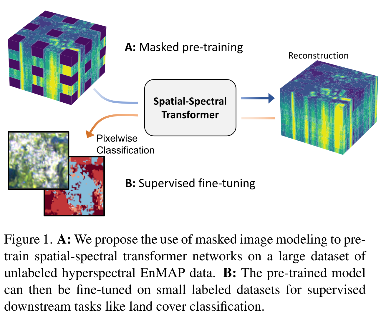
Masked Vision Transformers for Hyperspectral Image Classification
📅 2023
🧑 Damian Borth | Michael Mommert | Linus Scheibenreif
The study demonstrates significant improvements in hyperspectral image classification by adapting vision transformers to the unique characteristics of hyperspectral data. Key contributions and benefits for AI4AGRI researchers include:
- Enhanced Model Accuracy: Spatial-spectral transformers outperform traditional models, improving land cover classification accuracy.
- Efficient Label Usage: Self-supervised pretraining on EnMAP data reduces reliance on labeled datasets, delivering strong results even with limited labels (0.1%-10%).
- EnMAP Data Potential: High-resolution hyperspectral data supports precision agriculture tasks like land cover mapping and crop health monitoring.
This research work is currently being used for ongoing AI4AGRI research, stay tuned for more!
Related in AI, Agriculture and Earth Observation
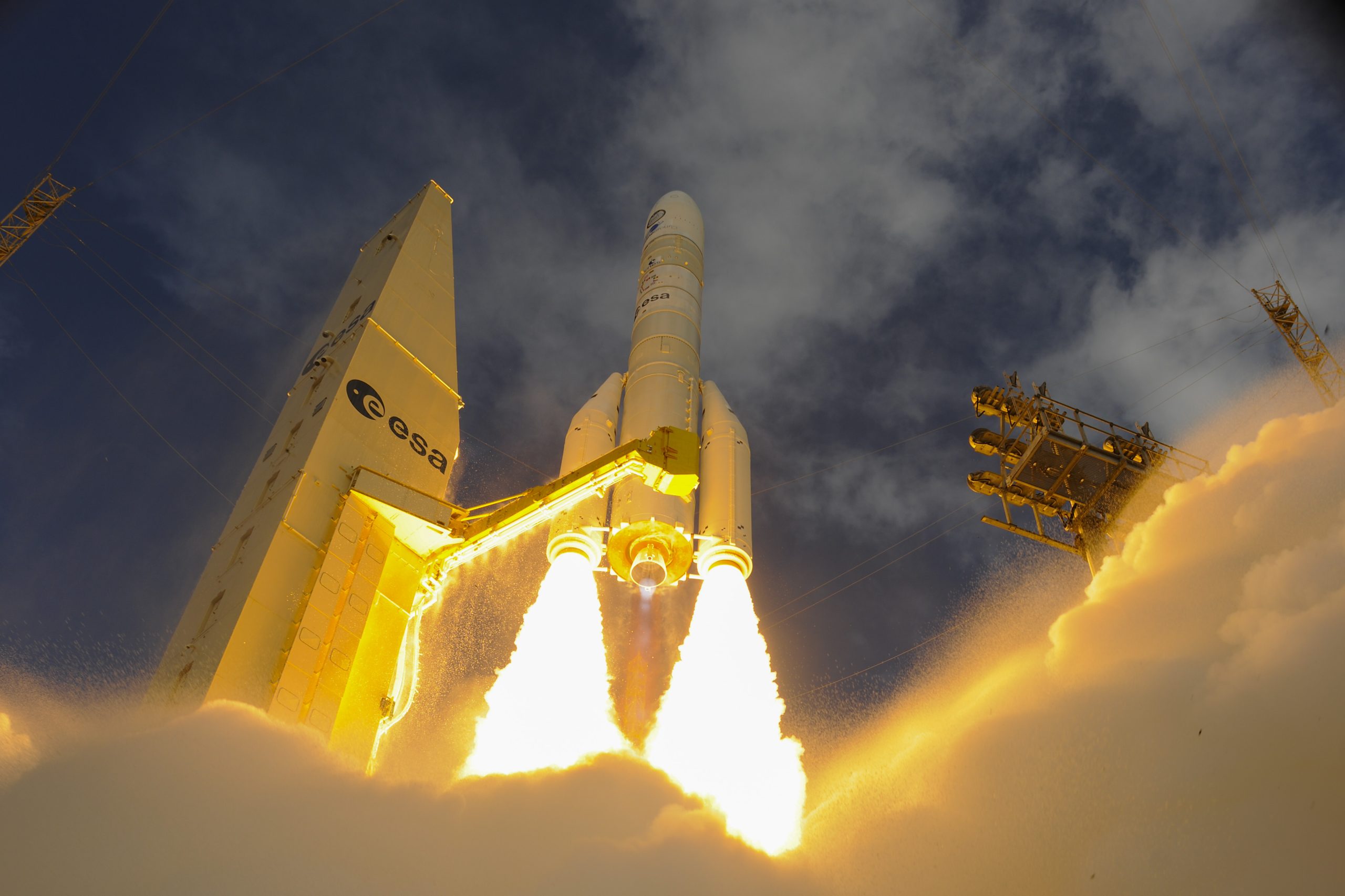
Ariane 6 takes flight ©ESA – S. Corvaja
ESA article: Ariane 6 to take Sentinel-1D into orbit
The Copernicus Sentinel-1D satellite is set to launch in the second half of 2025 aboard the Ariane 62 rocket. As the fourth satellite in the Sentinel-1 mission, it will replace the aging Sentinel-1A, ensuring continued global Earth observation capabilities. The satellite is equipped with advanced radar technology, providing all-weather imaging for applications like sea-ice monitoring, marine surveillance, and disaster response. New features include enhanced maritime traffic detection through an integrated Automatic Identification System, improving vessel tracking accuracy with onboard antennas that capture key data such as identity, location, and direction.
Source
Related Internships & Job Offers
Job Opportunity: Geomatics Research Engineer (CDD, 15 months)
📍 CESBIO – Toulouse, France
📅 April 1, 2025 | 15 months
€2,466 – €2,632 gross/mo
The Toulouse’s CESBIO lab in is hiring a Geomatics Research Engineer to produce labeled land-use patches for deep learning applications. Responsibilities include integrating GIS databases, generating and sampling patches, and using machine learning and photo interpretation to address data gaps.
More details: https://emploi.cnrs.fr/Offres/CDD/UMR5126-VINTHI-003/Default.aspx
The AI4AGRI project received funding from the European Union’s Horizon Europe research and innovation program under the grant agreement no. 101079136.
Publishing managers: J. Mothe & S. Molina, UT3 & UT2, IRIT, France