
Member highlight: Max Chevalier – IRIT / IUT Toulouse-Auch-Castres (France)
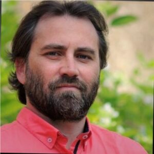
Max Chevalier is a Computer Science professor at the IUT Toulouse-Auch-Castres and a senior member of SIG research team at Toulouse Computer science Research Institute (IRIT). Since 2025, he is head of the Computer Science Department at IUT Toulouse-Auch-Castres.
His research interests span data management, information systems, and knowledge discovery, with a strong recent focus on data-driven Artificial Intelligence and Explainable AI (XAI). His current projects address challenges in graph-based data alignment and automated selection of XAI methods (AutoXAI). He also works on personalized information access, clustering of mixed data, and legal entity recognition using large language models.
Max Chevalier actively contributes to the French research community through his roles as a member of the national university committee (CNU 27) and the national parity commission for Computer Science and Data Science.
In AI4Agri, he participated to the workshops and visits organized in Toulouse and also contributed on the definition of research directions.
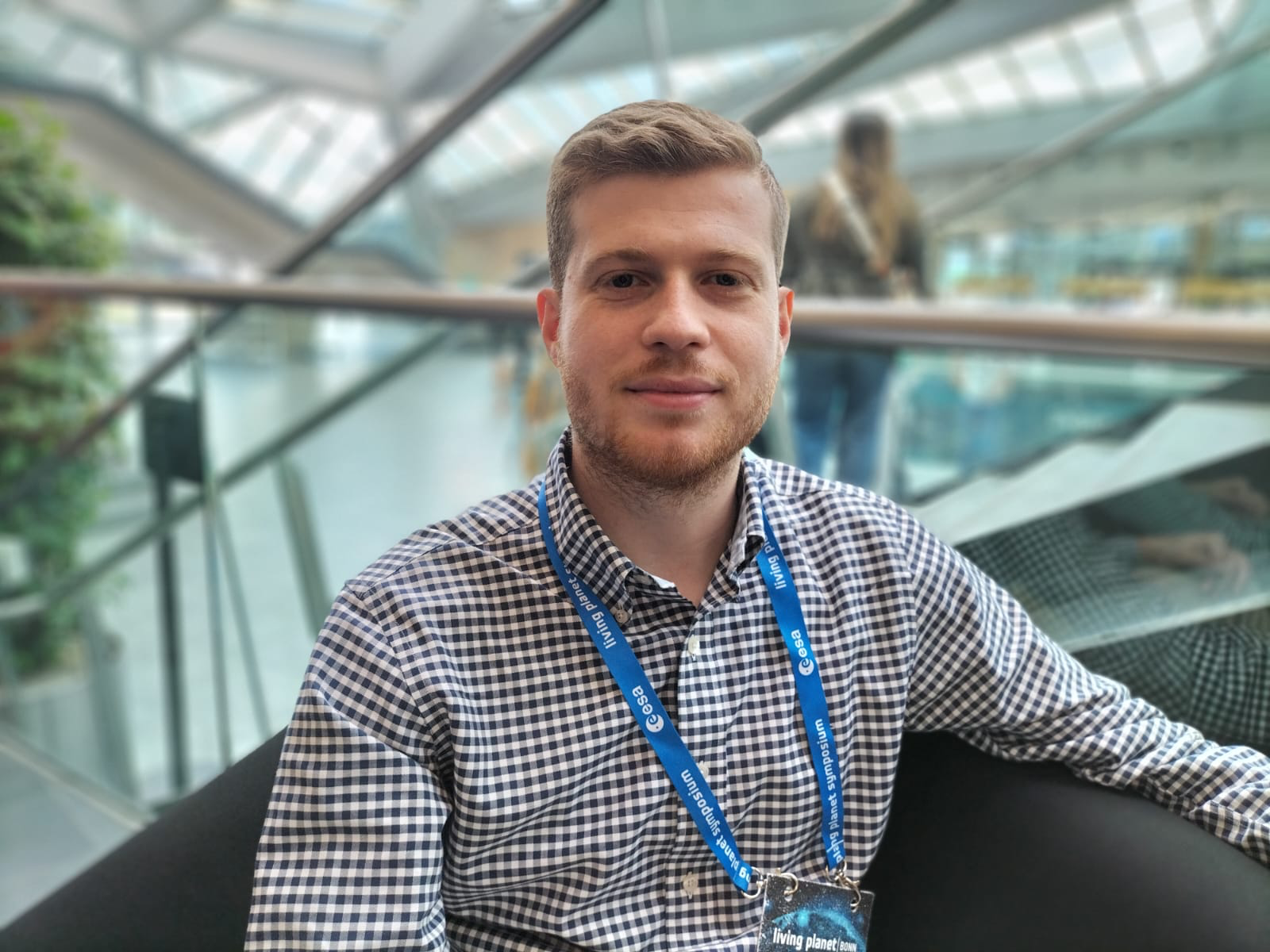
Member highlight: Serge Molina – IRIT (France)
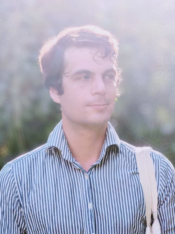
Serge Molina studied computer science through a Technological University Diploma (DUT) at Blagnac Institute of Technology (IUT), and later completed an Engineering Diploma in Interactive and Robotic Systems (SRI) at UPSSITECH, an engineering school embedding in Toulouse University (UT).
He currently works as a research engineer (ingénieur d’étude) at Toulouse Computer Science Research Institute (IRIT) SIG’s team, where he contributes to research in fields of natural language processing and information retrieval, with a focus on language models applied to low resource languages.
Serge Molina has acquired international research experience at Ilmenau Techincal University‘s Media Technology Institute where he first worked as an intern on visual saliency prediction for 2D images as well as a research assistant focusing on head motion estimation for 360° video content viewed through head-mounted displays (HMDs).
Additionally, he completed an internship at Deutsche Telekom, where he adapted a state of the art perception-based video quality model, originally developed for standard-resolution video, to the modern use case of 4K video streaming.
Within the framework of the AI4AGRI project, he participates to newsletter publication and keeping the website updated with project-related events and news.
News
AI4AGRI Monthly meeting
📅 Mon. 21 July – 14:00 (Fr/It time) | 15:00 (Ro time)
AI4AGRI members participation to UNIVERSEH’s PhD Workshop on AI and Space
The UNIVERSEH PhD Workshop on AI and Space, held online on 3-4 June 2025, brought together around 40 PhD students to explore the intersection of artificial intelligence and space sciences.
Members of the AI4AGRI project participated as lecturers:
- On the first day, Josiane Mothe (Université Toulouse – Jean Jaurès) introduced participants to the convergence of AI and space, setting the stage for interdisciplinary discussions.
- The second day featured Fabio Del Frate (University of Rome Tor Vergata) insights on Earth Observation data and its applications in agriculture, followed by Mihai Ivanovici (Transilvania University of Brașov) presentation on European projects integrating AI with space technologies.
- The workshop concluded with a roundtable on interdisciplinarity and the future of AI in the space sector, where Josiane Mothe engaged in discussions on AI ethics and open data.
AI4AGRI joins EARSeL
The European Association of Remote Sensing Laboratories (EARSeL) is a scientific network that promotes the development and application of remote sensing across Europe. With its recent membership in EARSeL, AI4AGRI – represented by Professor Mihai Ivanovici – joins a vibrant community dedicated to advancing Earth observation. Through this collaboration, AI4AGRI will benefit from shared expertise, access to thematic working groups, and visibility in leading European forums.
AI4AGRI Upcoming Events
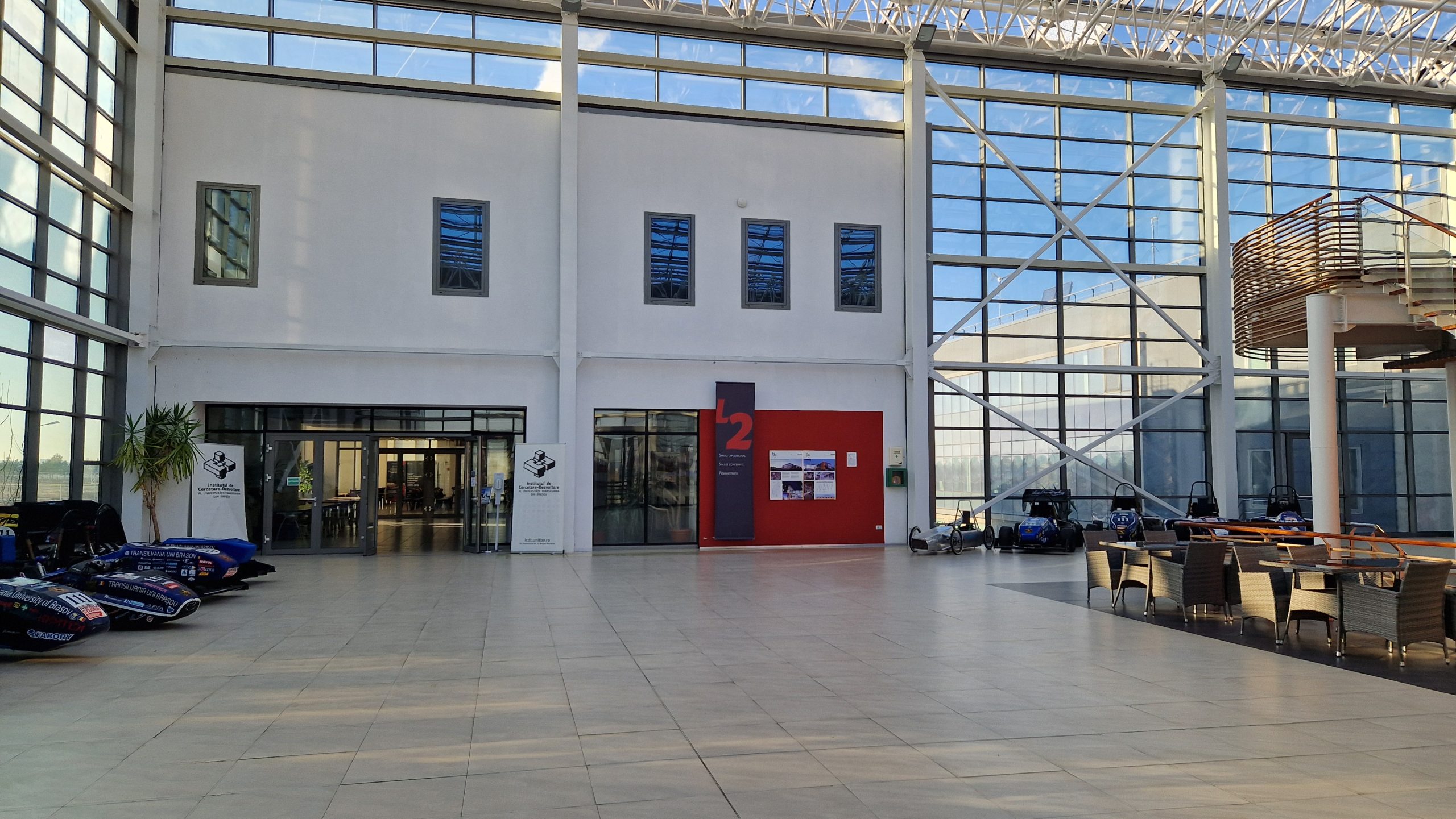
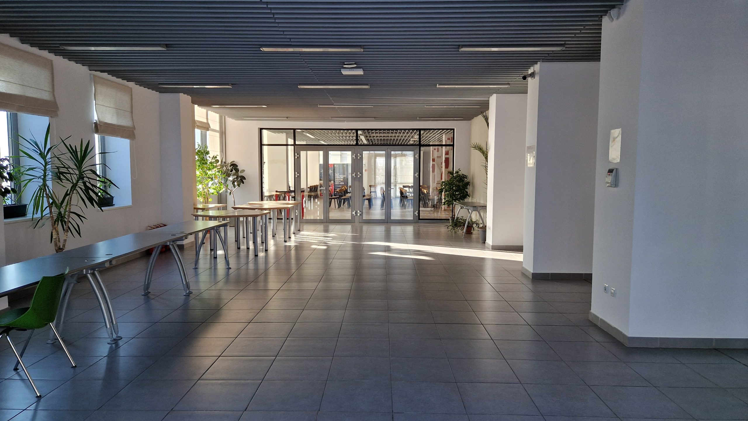
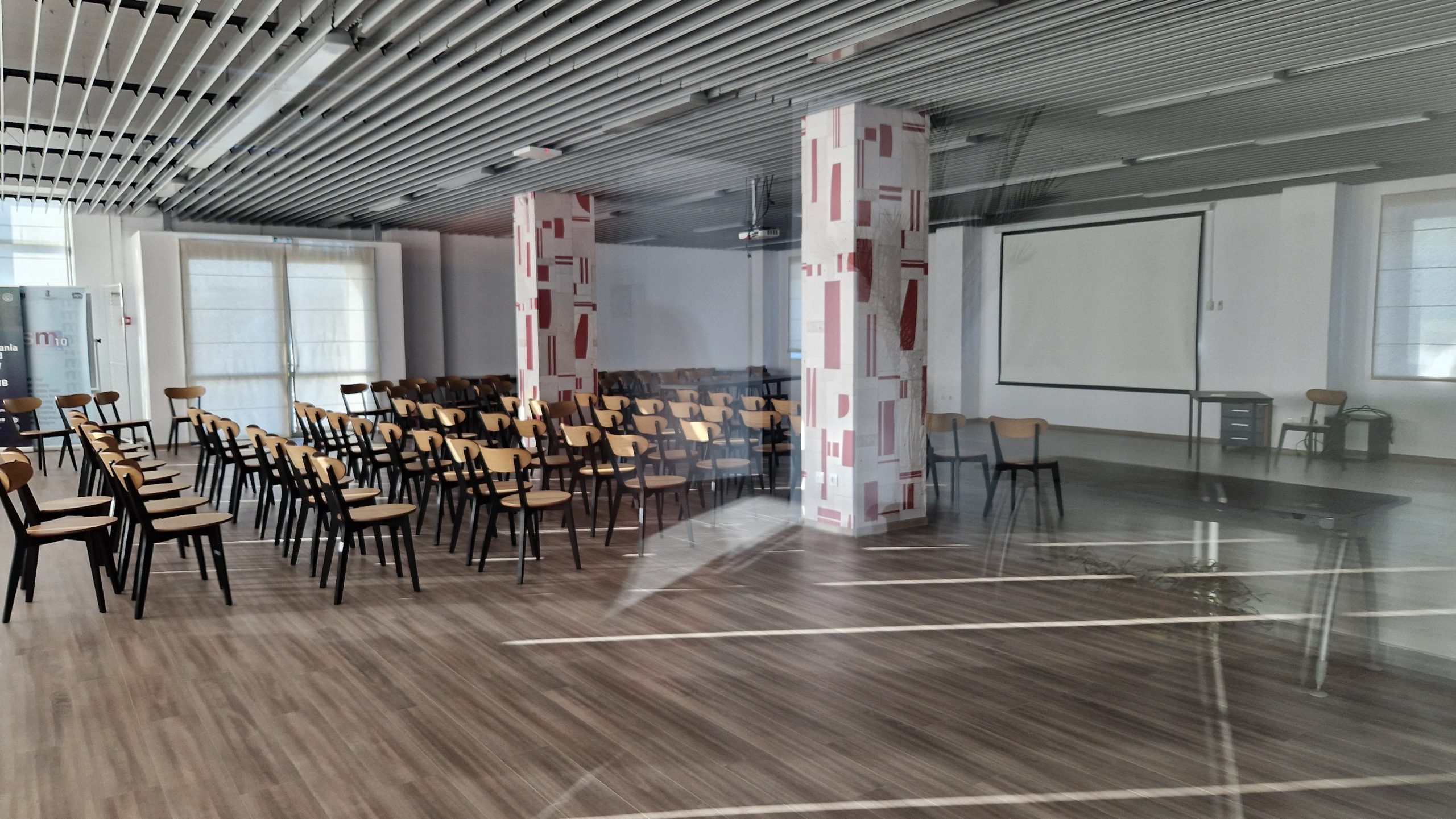
AI4AGRI Summer School venue at ICDT
AI4AGRI Summer School 2025 is getting closer!
📅 Mon. 14 – Sat. 19 July 2025
📍 ICDT, Brașov, Romania
AI4AGRI members are looking forward to welcoming AI4AGRI’s Summer school participants at R&D Institute of Transilvania University of Brașov in Brașov, Romania, from 14 to 19 July 2025.
During this event, participants will explore:
- Big Data, Deep Learning, and Machine Learning
- Advances in Remote Sensing for Agriculture
- Data Preprocessing, Visualization, and Denoising
- Real-world EO data applications in agriculture
To conclude the summer school, participants will gather for a brunch in the potato field at the National Institute of Research and Development for Potato and Sugar Beet.
See you in July in Brașov!
Lorenzo Giuliano Papale PhD Defence
🧑 Lorenzo Giuliano Papale
📅 Mon. 7th July 2025
Lorenzo Giuliano Papale, a PhD Candidate in GeoInformation at University of Rome Tor Vergata previously featured in the AI4AGRI’s newsletter, will defend his PhD Monday July 7th on the topic of Physical Models and Artificial Intelligence for Geophysical Parameters Retrieval and Weather Predictions.
Latest AI4AGRI Publications
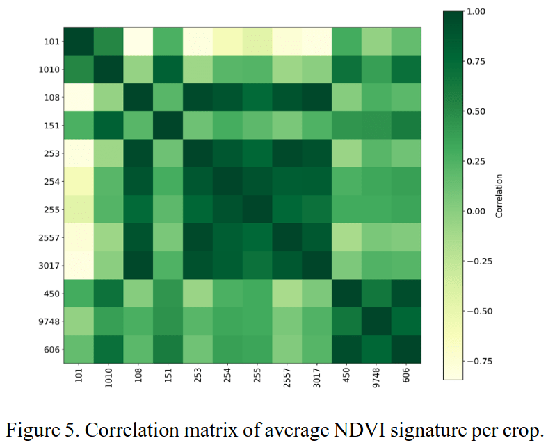
Multi-year multi-crop correlation analysis in Brasov area
🧑 Ioana C. Plajer, Alexandra Băicoianu, Matei Debu, Maria Ștefan, Mihai Ivanovici, Corneliu Florea, Adrian Ghinea, Luciana Majercsik
📅 2025
“Artificial Intelligence (AI) models are currently deployed in smart agriculture for various applications like crop monitoring and identification or yield estimation. AI models rely on huge amounts of data; thus, the first concern is the size and quality of labeled data for training such models. The second main concern is the explainability of the results produced by AI models. In this article, based on the 5-year data set we previously produced and published, we perform a correlation analysis in the attempt of explaining the performance of an AI model in a crop identification scenario.“
https://doi.org/10.5194/isprs-archives-XLVIII-M-7-2025-195-2025
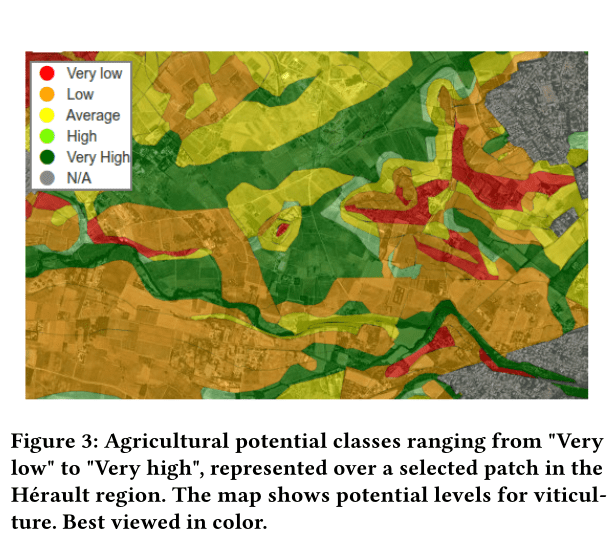
AgriPotential dataset publication
🧑 Mohammad El Sakka, Caroline De Pourtales, Lotfi Chaari, Josiane Mothe
📅 2025
Mohammad El Sakka, previously featured in AI4AGRI’s newsletter, has published a dataset along with Caroline De Pourtales, Lotfi Chaari, and Josiane Mothe, for agricultural potential assessement:
“[AgriPotential is] a publicly available benchmark dataset designed for assessing agricultural potentials using remote sensing data. It integrates 11 Sentinel-2 satellite images from 2019 across 10 spectral bands, covering agricultural regions in the Hérault Department, Southern France.
The dataset includes pixel-wise labels representing agricultural potential levels (from Very Low to Very High) across three crop types: viticulture, market gardening, and field crops. Ground truth annotations are derived from the BD Sol-GDPA database and validated by domain experts. […]“
https://zenodo.org/records/15556484
AI4AGRI publications at IGARSS 2025
Abstract and details will be included in September’s newsletter, once the papers have been officially published
A NN APPROACH FOR PRECIPITATION RETRIEVAL USING TROPICS DATA
🧑 Ilaria Petracca, Fabio Del Frate, William J. Blackwell, Vincent Leslie, Kerri Cahoy
A CNN-BASED APPROACH FOR UNDERSTANDING SAR BACKSCATTERING OF BARE SOIL
🧑 Kamal Marandskiy, Lorenzo G. Papale, Mihai Ivanovici, Fabio Del Frate
EVALUATION OF PRISMA HYPERSPECTRAL DATA DIMENSIONALITY REDUCTION: CASE STUDIES IN LAND AND ATMOSPHERIC DOMAINS
🧑 Sarathchandrakumar T. Sasidharan, Davide De Santis, Marco Di Giacomo, Giovanni Schiavon, Fabio Del Frate
Related Upcoming Events
O3T Key Challenge annual seminar 2025
📅 Thursday 3 July 2025
📍 IRIT auditorium – Cr Rose Dieng-Kuntz, 31400 Toulouse
The annual seminar of the Défi Clé O3T will take place on Thursday, July 3, 2025, from 9:00 AM to 5:00 PM at the IRIT Auditorium in Toulouse. The event will feature opening remarks from representatives of the Occitanie Region, the DROCC-Est operational center, and the scientific lead of the Défi Clé O3T.
The program includes plenary sessions on Earth observation data access and O3T research outcomes, a flash presentation segment by PhD students and interns, a “World Café” on data sharing, a poster session during lunch, and a roundtable discussion.
The day will conclude with a presentation from the Mediterranean Institute for Environmental Transition (ITEM) and a closing reception.
Josiane Mothe from the AI4AGRI project will take part as presenter during this seminar.
Related Publications
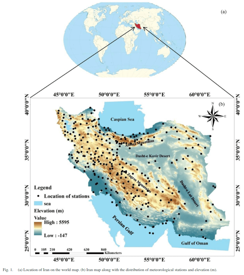
Assessment of Spatiotemporal Characteristic of Droughts Using In Situ and Remote Sensing-Based Drought Indices
🧑 Sepideh Jalayer et al.
📅 2023
“Drought has been identified as one of the significant complicated natural disasters exacerbated by land degradation and climate change. Hence, monitoring drought and evaluating its spatiotemporal dynamics are essential to manage regional drought conditions and protecting the natural environment. In this study, various single remote sensing-based drought indices including soil moisture condition index (SMCI), precipitation condition index (PCI), temperature condition index (TCI), and vegetation condition index (VCI) and combined RS-based drought Indices including optimized meteorological drought index (OMDI) and synthesized drought index (SDI) have been used to investigate the spatiotemporal variations of meteorological and agricultural droughts between 2000 and 2021 in Iran. The in situ drought indices, including the standardized precipitation index (SPI) and standardized precipitation evapotranspiration index (SPEI) series of 1, 3, 6, 12, and 24 months were utilized to verify remote sensing-based drought indices and evaluate their applicability for analyzing drought conditions. The results indicated that the correlation coefficients of the in situ drought indices with the combined drought indices are higher than the RS-based single drought indexes. […]”
Related news in AI, Agriculture and Earth Observation

Call for Projects: Postdoctoral Contracts in Occitanie for O3T Project
📅 Deadline: July 21, 2025
A new call is open to fund postdoctoral research contracts in the Occitanie region, as part of the multidisciplinary project O3T – Earth Observation and Territories in Transition.
The projects must address at least one of the following three research axes:
- Low-cost instrumentation (e.g. field measurements, affordable sensors)
- Data retrieval and exploitation (storage, processing, analysis, visualization, sharing)
- Operationalization, awareness-raising, and co-construction of data and observatories with territories (collaborative frameworks between researchers and local actors)
Targeted environments include urban, rural, coastal, and mountain areas. Projects must respond to concrete operational needs tied to territorial transitions and demonstrate strong practical relevance.
Priority will be given to initiatives that include a 2–6 month immersion in an operational structure (e.g. local authority, NGO, national park, state agency, or social sciences lab active in fieldwork).
https://o3t.univ-toulouse.fr/lancement-dun-nouvel-aap-pour-le-financement-de-contrats-postdoctoraux/

2026 Call for Projects – National Program for Space-based Remote Sensing (PNTS)
The 2026 Call for Projects from the National Program for Space-based Remote Sensing (PNTS) supports innovative, exploratory research using satellite Earth observation. Funded by CNES, CNRS-INSU, IGN, IRD, and Météo-France, PNTS encourages studies related to instrument development, measurement physics, new data processing methods, validation of satellite products, and advanced methods like AI and data fusion.
Projects must be 1-3 years, with a minimum request of €5,000/year, and submitted via SIGAP between June 1 and September 5, 2025 (17:00, Paris time).
Eligible costs include:
- Operational expenses (supplies, travel, small equipment),
- Data purchases (e.g., satellite images),
- Laboratory or in situ analyses,
- Internship grants (Master’s level).
Personnel salaries (except internships) and large, unrelated equipment are not funded. All proposals require a 10-page scientific file and must include a sustainability assessment. Collaborations and co-funding are encouraged.
Postdoc: Estimation of beet yellowing severity and propagation by satellite image time series
📍 DYNAFOR, Toulouse, France
The postdoctoral researcher will contribute to the BEET-SAT (PNRI-C) project hosted at the DYNAFOR laboratory in Toulouse, France, with a focus on estimating the severity and spatial propagation of beet yellowing using satellite image time series (SITS). The position is supervised by researchers at Toulouse INP, INRAE, and the Purpan Engineering School.
The postdoc will:
- Contribute to the development of a robust, scalable method for tracking beet yellowing.
- Analyze multi-year Sentinel-2 data to understand the seasonal spectral behavior of beet crops.
- Assess the influence of spatial resolution on disease detection.
- Investigate the added value of integrating satellite observations with simulation models.
- Apply Python-based workflows and machine learning tools to process and analyze spatial and spectral data.
- Work in a multidisciplinary environment, combining expertise in remote sensing, agronomy, and spatial modeling.
https://ai4agri.unitbv.ro/wp-content/uploads/2025/06/offrePost-doc_BEET-SAT.pdf
Postdoc: Phytoplankton blooms diversity and dynamics in coastal waters
📍 ISOMer, Nantes University, France
The post-doctoral researcher will contribute to the “Land-Sea interface: Let’s observe together!” (LandSeaLot) project, with a focus on understanding phytoplankton dynamics, particularly Harmful Algal Blooms (HABs) and red tide events, in the coastal waters off the Seine Estuary (France).
The postdoc will:
- Support the creation of an integrated database combining long-term in situ data and satellite-derived observations.
- Analyze spatio-temporal patterns of dominant phytoplankton taxa to improve HAB and red tide monitoring.
- Apply satellite time series based analysis for mapping bloom-related phytoplankton groups and phenoregions.
- Validate satellite products with field data.
- Occasionally take part in fieldwork, collecting seawater samples and optical measurements.
- Assist in post-processing of field data.
- Conduct cross-disciplinary analyses integrating marine ecology and ocean colour remote sensing to deepen understanding of bloom dynamics in river-influenced coastal zones.
Postdoc: Automatic Mapping of Roadsides for Hydro-Sedimentary Connectivity Studies
📍 UMR IDEES, University of Caen Normandy, France
The postdoctoral researcher will contribute to the ARHYCO project hosted at Caen’s IDEES laboratory. The project focuses on understanding the role of roadsides in shaping surface water and sediment transfers in small agricultural catchments, using remote sensing and geomatics approaches.
The postdoc will:
- Develop robust, transferable methodologies for automatically detecting and mapping roadside features across landscape scales.
- Analyze multi-source remote sensing data to extract biophysical and structural indicators.
- Contribute to building a reproducible data processing pipeline combining digital image processing, machine learning, and data fusion techniques.
- Test spatial resolution enhancement methods using high-resolution drone imagery to improve satellite data interpretation.
- Participate in field campaigns including terrestrial laser scanning and UAV data acquisition to validate remote sensing outputs.
- Work in close collaboration with researchers in geography, ecology, and hydrology, and coordinate with other project work packages.
- Disseminate results through scientific publications, technical reports, and conferences.
The AI4AGRI project received funding from the European Union’s Horizon Europe research and innovation program under the grant agreement no. 101079136.
Publishing managers: J. Mothe & S. Molina, UT3 & UT2, IRIT, France