
📅 October 2023
🧑 K. Marandskiy, M. Ivanovici, S. Corcodel and S. Costache
#Estimation #Soil #Gray-scale #Autonomous aerial vehicles #Fractals #Complexity theory #Remote sensing
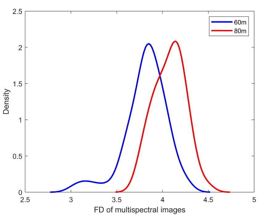
Image complexity can provide useful information about the texture or material properties of the acquired scene. In agriculture, the complexity of remotely-sensed images of soil or land cover may reveal underlying properties of soil and/or vegetation. However, the perceived complexity may vary along scales, as a function of the altitude of the sensor. In this paper, we investigate how the fractal complexity of multispectral images acquired using an unmanned aerial vehicle varies with the altitude, in a soil roughness estimation application. We adapt a definition of the multi-spectral fractal dimension to assess the fractal complexity of images with 5 spectral bands and analyze the computed fractal complexity as a function of both altitude and the number of considered spectral bands. For the 60m and 80m altitudes, the perception of complexity is inverted with respect to expectations.
https://ai4agri.unitbv.ro/wp-content/uploads/2024/04/K_Marandskiy_WHISPERS_2023.pdf
Marandskiy, K., Ivanovici, M., Corcodel, S. and Costache, S., 2023, October. Multispectral Fractal Image Analysis for Soil Roughness Estimation at Various Altitudes. In 2023 13th Workshop on Hyperspectral Imaging and Signal Processing: Evolution in Remote Sensing (WHISPERS) (pp. 1-5). IEEE.
@inproceedings{marandskiy2023multispectral,
  title={Multispectral Fractal Image Analysis for Soil Roughness Estimation at Various Altitudes},
  author={Marandskiy, Kamal and Ivanovici, Mihai and Corcodel, Stefan and Costache, Sabina},
  booktitle={2023 13th Workshop on Hyperspectral Imaging and Signal Processing: Evolution in Remote Sensing (WHISPERS)},
  pages={1--5},
  year={2023},
  organization={IEEE}
}